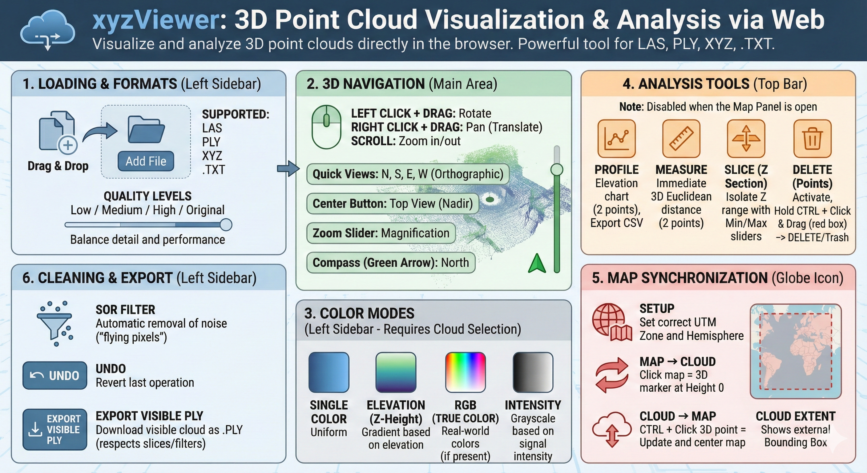
Welcome to xyzViewer, V. 072026, a powerful and intuitive free tool for visualizing and analyzing 3D point clouds directly in your browser.
Main Features
- Easy Loading: Simply drag & drop your files into the center of the screen or use the upload button. Select display quality based on your device's performance.
- Advanced Analysis:
- Profile: Generate profiles by clicking two points.
- Measure: Calculate 3D distance between points.
- Slice (Z-Section): Isolate specific height ranges using sliders.
- Editing & Cleaning: Use the Delete key to manually remove selected points, or enable the SOR Filter (Statistical Outlier Removal) to automatically clean noise and "flying pixels."
- Maps & GeoTIFF: Sync the 3D view with satellite maps. Supports UTM zone alignment and custom geotiff and dxf map overlays (.tif).
- Export: Download your work (including cuts and cleaned data) as a PLY file.
- Alignment: Cloud to cloud automatic matching.
- XYZ to LAS Converter: Convert heavy .XYZ text files into optimized .LAS files for better performance and manageability. Open Converter Tool.